Recognizing Bay Area Roots
Sponsored by
RECOMMENDED AGE LEVEL
Recommended for ages 5 and up with adult supervision.
PROJECT DESCRIPTION
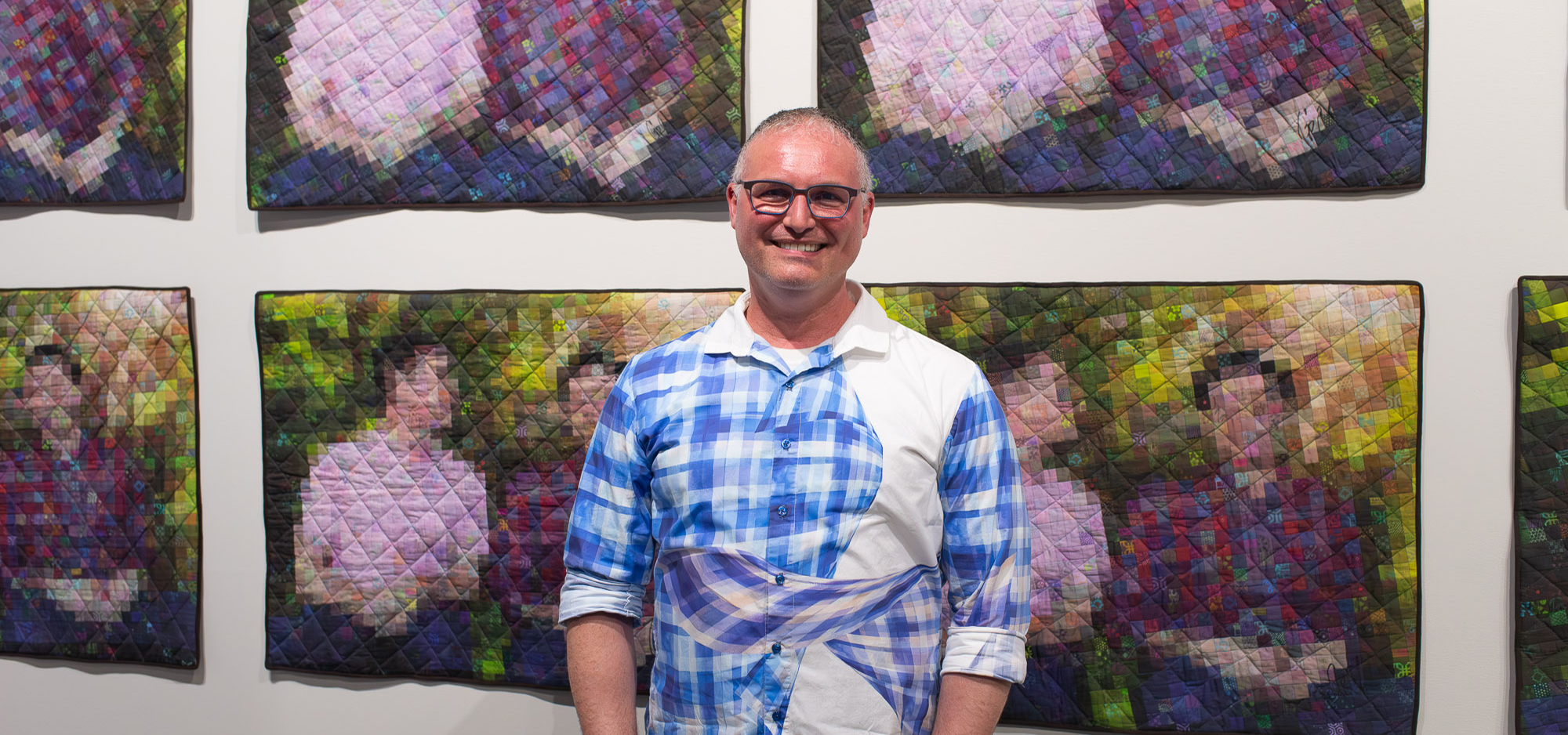
In correlation with the upcoming virtual event with Cafe Ohlone, cafe founders and Ohlone community leaders Louis Trevino and Vincent Medina co-produced this project about decolonizing place and better understanding the Bay Area’s Indigenous political landscape. Use clay (foraged or purchased!) or homemade salt dough to create a 3D puzzle map exploring the pre-Columbian history of San Francisco and its neighboring regions. Use the time working the material to contemplate a better understanding of Native spatial visualization and the role of the land in societal organization. Visit our current exhibition, Imagining Data, for tantalizing examples of cartographic and databased art.
About mak-‘amham/Cafe Ohlone: We are an Ohlone cultural institution empowering our Indigenous community with tradition—and we teach the public, through taste, of our unbroken roots. mak-‘amham/Cafe Ohlone operates in our Indigenous East Bay homeland; this work, made possible by our elders, is centered on reviving and strengthening traditional Ohlone cuisine and culture for the well-being of our community, and to honor those who came before us. Through mak-‘amham, we lead weekly Chochenyo and Rumsen language classes, gathering trips, cultural and cooking classes to ensure traditional culture grows stronger within our Ohlone community. We also operate Cafe Ohlone, where decadent, multi-course meals are prepared with ingredients that have been loved by generations of our family
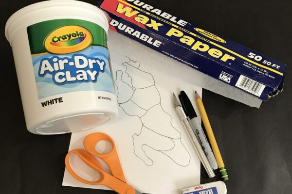
MATERIALS
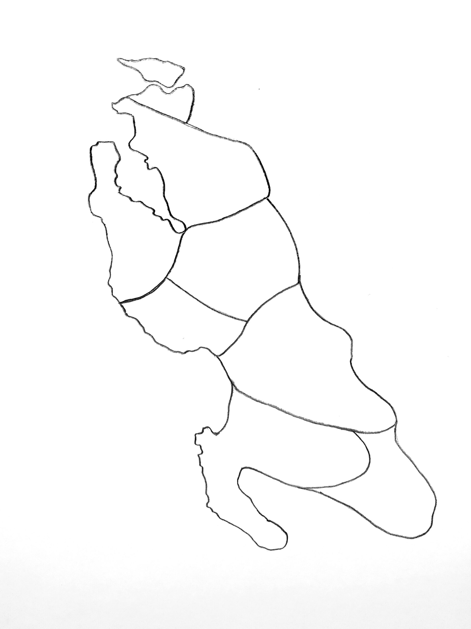
Microstate map template
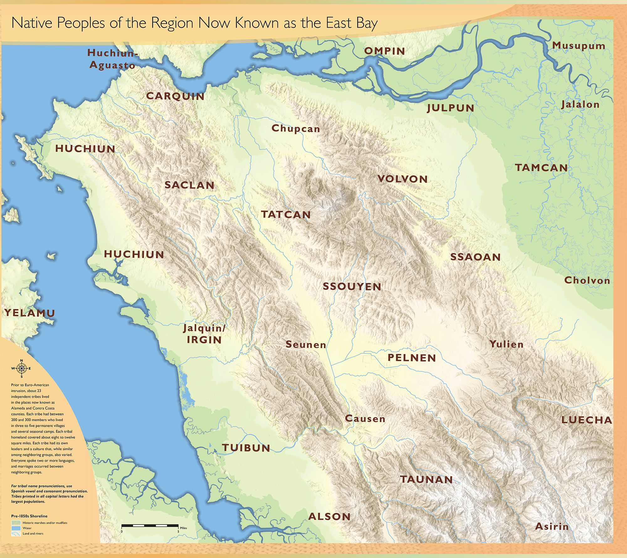
Nations and languages map
Wax or parchment paper
Permanent marker
Air dry clay or salt dough
X-ACTO knife or wooden skewer
Optional Materials:
Pencil and paper for creating original template
Paint/Color markers
Beads
Glitter and/or food coloring
INSTRUCTIONS
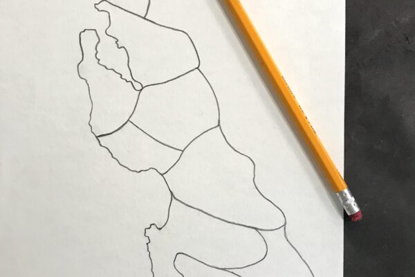
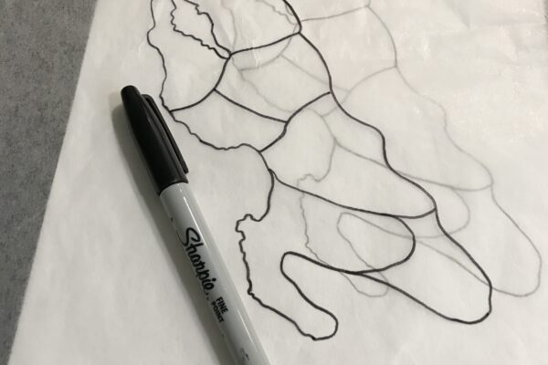
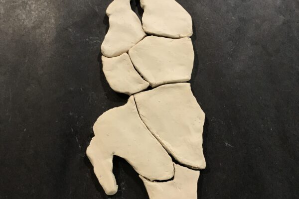
- Print or trace the microstate map template.
- Place the template under a sheet of wax paper and use a permanent marker to trace it.
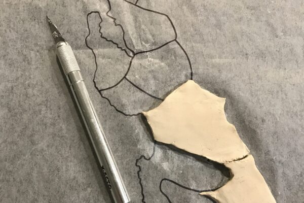
- Apply clay to the template, leaving enough space between the boundaries to have separate pieces.
- Use an X-ACTO blade or other sharp tool to help define the shapes of each piece.
TIP: kids can use a colored pencil or wooden skewer with the tip snipped off.
- Use an X-ACTO blade or other sharp tool to help define the shapes of each piece.
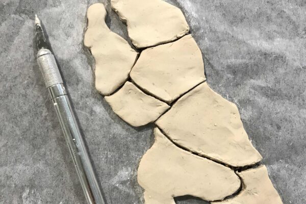
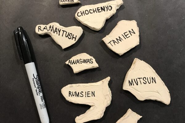
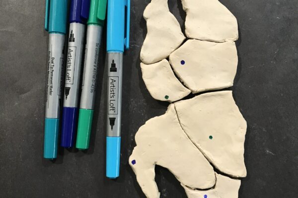
- When the clay has completely dried, flip over your pieces and begin labeling the regions according to Ohlone nations/languages found on the provided map.
- These regions include:
- Awaswas (Santa Cruz)
- Chalon (Soledad)
- Chochenyo (Oakland)
- Karkin (Vallejo)
- Mutsun (Gilroy)
- Ramaytush (San Francisco)
- Rumsien (Carmel)
- Tamien (San Jose)
- These regions include:
- Note that many nations cover more than one contemporary city; example: Halkin/Jalquin is the original name of San Leandro, Castro Valley, San Lorenzo, Hayward and southern Oakland, and is the same nation as ‘Irhin, however these two names are reflected differently by place. Xucyun/Huchiun is the original name of downtown, west and north Oakland, but also Emeryville, Berkeley, and El Cerrito. Yelamu covers the modern City of San Francisco. Many of these place names are using a Spanish language spellings that differ from the Ohlone orthography.
- After the clay pieces have been labeled, flip them over and assemble your map.
- Practice memorizing the nation names by reassembling and flipping over the puzzle pieces like flash cards.
- Reflect on what this part of the Bay Area looked like politically before the hardships of colonization arrived. Note that these are nation names, and large villages, each with proper names of their own, are within each of these sovereign states. We hope this map teaches you that the Bay Area is an ancient place, settled from time immemorial, and that the first people are alive and well, still living in our traditional lands.
Creative Data Visualizations:
- Use markers or paint to denote current cities or places you know.
- Use the Ohlone nations map to compare Indigenous boundaries to geographic landmarks you may be more familiar with, such as the Golden Gate Bridge or your own home.
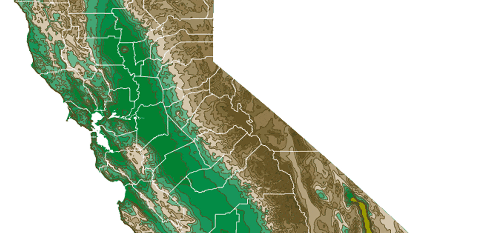
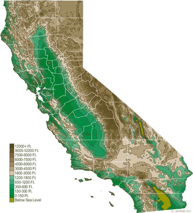
- To add geographic detail and complexity to your project, refer to a topographic map of California.
- Draw or sculpt topographical elements into your pieces.
- Mix food coloring or glitter into the clay or dough as a way to differentiate the regions.
- Paint the pieces once they are dry.
- How can you use color to blur the “borders” of the microstates—especially in those areas where more than one language is spoken?
- Use recycled fabric to create a simple pouch to hold the map pieces and keep them safe.
RELATED RESOURCES
- Watch: Vincent Medina (Muwekma Ohlone) presents a story about the Blood Monster in the Chochenyo language.
- Cafe Ohlone featured in the Tending Nature docuseries.
- Where did maps come from? How have they shaped our world? Read more about the complex and conflicted history of mapmaking.
UPCOMING EVENTS
Free Summer Weekend!
The Fabric of Celluloid: A Conversation with Dr. Alla Gadassik

